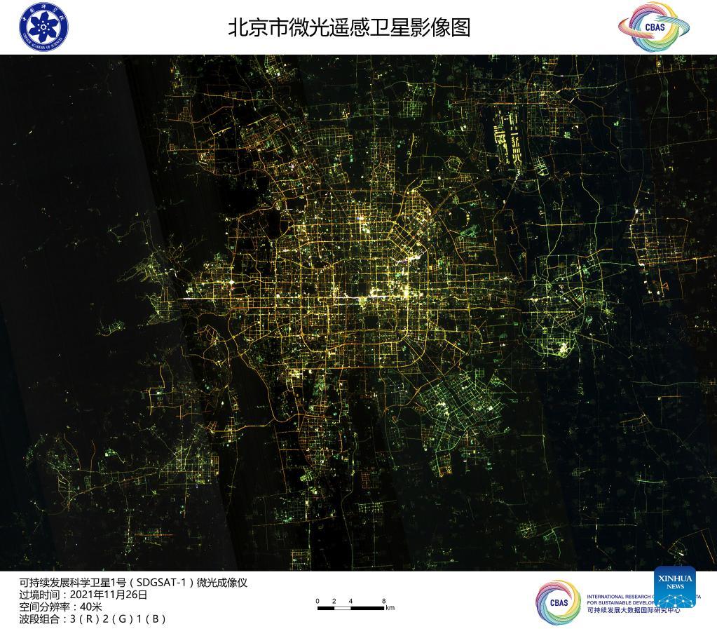
China's Earth science satellite transmits images home
Xinhua |
Updated: 2021-12-21 08:53
Share
Share - WeChat
CLOSE
Image captured by the satellite SDGSAT-1 shows a view of Beijing, capital of China. China's recently launched Earth science satellite has sent back its first remote sensing images, according to its developer, the Chinese Academy of Sciences (CAS). Using thermal infrared, low light level and multispectral imagers, the satellite captured images of multiple cities and regions, including Beijing, Shanghai, the Yangtze River Delta, Lake Namtso in Tibet, Aksu Prefecture in Xinjiang, and Paris in France. The satellite SDGSAT-1 is the world's first space science satellite dedicated to serving the UN 2030 Agenda for Sustainable Development. The satellite was launched into space on Nov 5. [Chinese Academy of Sciences/Handout via Xinhua]
Copyright 1994 - . All rights reserved. The content (including but not limited to text, photo, multimedia information, etc) published in this site belongs to China Daily Information Co (CDIC). Without written authorization from CDIC, such content shall not be republished or used in any form. Note: Browsers with 1024*768 or higher resolution are suggested for this site.